How Geofencing Improves Dispatch Precision in Ground Alliance
by admin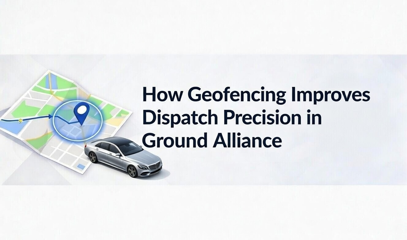
The luxury ground transportation industry loses an estimated 15-20% of operational efficiency to dispatch delays and misassigned chauffeurs—a challenge that geofencing technology is uniquely positioned to solve. For limo fleet operators using Ground Alliance software, integrating geofencing transforms dispatch from a reactive guessing game into a precision-driven operation. This technology creates invisible GPS boundaries around service zones, triggering automatic alerts and actions when chauffeurs cross them. The result? Assignment errors drop by 30-50%, wait times shrink, and fleet managers gain real-time visibility that was previously impossible.
Geofencing works by establishing virtual perimeters around physical locations—airports, hotels, corporate headquarters, or entire service districts. When a chauffeur equipped with the Ground Alliance mobile app enters or exits these zones, the system instantly updates their status and availability. Dispatchers no longer rely on manual check-ins or phone calls to determine vehicle positions. Instead, they see live data showing which chauffeurs are approaching pickup zones, who's stuck in downtown traffic, and which vehicles just completed dropoffs and are ready for new assignments. This fundamental shift from reactive to proactive dispatch management explains why forward-thinking limo operators are making geofencing a core component of their technology stack.
Geofencing Mechanics in Dispatch
Understanding how geofencing mechanics work in Ground Alliance requires looking at the technology stack that makes precision tracking possible. The system relies primarily on GPS coordinates from driver smartphones, with accuracy typically ranging from 5-10 meters under optimal conditions. Some operators enhance this with RFID readers at key locations like garage entrances or VIP terminals, creating redundant verification that ensures chauffeurs are exactly where the system indicates.
When a dispatch manager creates a geofence in Ground Alliance, they're essentially drawing a digital circle or polygon on a map. The platform continuously monitors GPS data from all active vehicles against these defined boundaries. The moment a coordinate point crosses from outside to inside a geofence—or vice versa—the system executes predetermined actions. These might include changing a driver's status from "en route" to "arrived," sending an SMS notification to the client, or automatically logging the timestamp for billing purposes. The entire process happens in seconds, without requiring any manual input from the chauffeur beyond simply driving their assigned route.
RFID integration adds another layer of precision for operators managing high-volume facilities. A chauffeur pulling into a designated airport staging area might trigger both a GPS-based geofence and pass through an RFID checkpoint. This dual verification ensures the system has sub-10-meter accuracy even in environments where GPS signals might bounce off buildings or face interference. For luxury ground transport companies serving major metropolitan areas, this precision prevents costly mistakes like dispatching a vehicle that's actually stuck in terminal traffic rather than ready at the curb.
Virtual Boundary Setup
Setting up geofences in the Ground Alliance dashboard takes minutes but requires strategic thinking about your service geography. Start by logging into the web-based control panel and navigating to the geofencing module, typically found under fleet management settings. You'll see a map interface where you can draw circular or polygonal boundaries by clicking anchor points around your target area. For a hotel pickup zone, you might create a 200-meter radius covering the entire entrance driveway and nearby holding areas. For highway routes or suburban estates, larger geofences spanning several blocks make more sense.
The platform allows custom radius settings that should reflect your operational environment. Urban zones benefit from tighter boundaries—a 100-meter geofence around a corporate headquarters entrance ensures you only trigger arrival notifications when chauffeurs are genuinely at the door, not stuck at a traffic light two blocks away. Highway or airport geofences often need 500-meter or larger radii to account for sprawling facilities and approach roads. Ground Alliance saves these configurations as templates, so you can quickly replicate your downtown hotel geofence pattern across 20 similar properties without redrawing each one individually.
Color coding and naming conventions prevent confusion when managing dozens of zones. Assign green boundaries to high-priority corporate accounts, yellow to airport terminals, and red to areas with known traffic complications. When a dispatcher glances at the live map showing 15 active vehicles, these visual cues instantly communicate where each chauffeur is positioned relative to critical zones. The system also supports time-based activation—a convention center geofence might only be active during event hours, preventing unnecessary alerts when the venue is closed.
Real-Time Trigger Actions
The true power of geofencing emerges when you configure automated trigger actions that execute without human intervention. Ground Alliance offers several pre-built automation templates: when a chauffeur enters a pickup geofence, the system can automatically send a "driver arriving" SMS to the client using masked phone numbers that protect driver privacy. When they exit a dropoff zone, their status flips to "available" and they re-enter the dispatch queue for new assignments. These micro-automations eliminate hundreds of manual status updates weekly, freeing dispatchers to focus on exception handling rather than routine logging.
Notification routing ensures the right stakeholders get alerts at the right time. A chauffeur entering an airport holding lot might trigger a silent dashboard update for dispatchers while sending nothing to clients. But entering the actual terminal pickup geofence fires both a dispatcher notification and a client SMS with the vehicle description and estimated arrival. Ground Alliance's integration with masked number systems means clients can call or text their driver without exposing personal phone numbers—the system routes communications through temporary bridge numbers that dissolve after the trip concludes.
Advanced operators layer multiple triggers on single geofences. A luxury hotel might have three concentric zones: an outer 500-meter "approaching" boundary that alerts the concierge desk, a 200-meter "nearby" zone that triggers client SMS, and a 50-meter "arrived" zone that starts the billing clock and logs the precise arrival timestamp for service-level agreement tracking. This graduated approach prevents alert fatigue while ensuring every stakeholder has the awareness they need at each stage of service delivery.
Dispatch Precision Gains
Quantifying geofencing's impact on dispatch precision reveals dramatic operational improvements. Before implementing automated zone tracking, a typical 50-vehicle limo fleet might average 8-12 minutes to match an incoming request with the optimal available chauffeur. Dispatchers would radio drivers to confirm positions, wait for callbacks, and manually cross-reference traffic conditions. With geofencing active, Ground Alliance's algorithm instantly identifies which vehicles are inside favorable zones, filters for availability, and auto-assigns the nearest option—collapsing response time to under 90 seconds.
This speed advantage compounds across a busy service day. An operation handling 200 trips daily saves over 30 dispatcher hours weekly just from faster assignment decisions. But precision isn't only about speed—it's about accuracy. Geofencing prevents the classic mistake of assigning a chauffeur who reported being "near the airport" but is actually stuck in terminal traffic three miles from the pickup curb. The system knows with 10-meter accuracy whether a vehicle is in the staging lot or circulating the access road, eliminating guesswork that leads to client frustration and last-minute reassignments.
Fleet utilization metrics also improve measurably. When dispatchers can see exactly which vehicles are truly idle versus which are approaching completion of current trips, they make smarter assignment decisions that reduce deadhead miles. One Ground Alliance operator in Los Angeles reported a 22% reduction in empty vehicle repositioning after six months with geofencing—chauffeurs spent more time with passengers and less time driving to distant pickup points because the system matched requests to genuinely nearby available units rather than drivers who'd optimistically reported their positions.
Error Reduction Examples
Real-world error reduction data demonstrates geofencing's practical value beyond theoretical benefits. A Chicago-based executive transportation company tracked wrong-zone assignments before and after implementing geofence triggers. In their pre-geofencing operations, roughly 18% of airport runs experienced some form of pickup confusion—chauffeurs arriving at Terminal 5 when the client was actually at Terminal 3, or vehicles staging at domestic arrivals instead of the international gate. These mistakes cascaded into service recovery costs: compensatory ride credits, expedited reassignments, and damaged client relationships.
After rolling out geofencing with terminal-specific boundaries, their error rate dropped to 4% within two months. The remaining errors stemmed mostly from client-side miscommunications rather than dispatch mistakes—cases where passengers genuinely changed terminals without notifying the service. The geofencing system couldn't prevent those scenarios, but it eliminated the dispatcher errors that previously constituted the majority of problems. Each prevented mistake saved an estimated 25 minutes of recovery time and preserved relationships with high-value corporate accounts that have zero tolerance for pickup failures.
Another pattern emerged in data from a Las Vegas Strip operator managing hotel transfers. Before geofencing, their dispatchers occasionally assigned vehicles to "Caesars Palace" pickups when chauffeurs were actually positioned at nearby but distinct properties like The Cromwell or The Linq—visually close on a map but separated by traffic patterns that added 8-12 minutes to pickup times. Geofencing with property-specific boundaries eliminated these confusions entirely. When a request came in for Caesars Palace, the system only considered vehicles physically inside that property's geofence or approaching from optimal directions, not drivers who happened to be on the same stretch of Las Vegas Boulevard but facing wrong-way traffic.
Urban Limo Challenges Solved
London's congested streets present a perfect case study for geofencing's impact on urban dispatch challenges. The city's combination of narrow roads, aggressive bus lanes, and unpredictable traffic makes chauffeur positioning critical—a vehicle 200 meters away might be 15 minutes distant if facing one-way systems and pedestrian zones. Ground Alliance operators in the UK capital create intricate geofence networks around West End theaters, Mayfair hotels, and Canary Wharf corporate towers that account for these access complexities.
One operator serving the City of London financial district established separate geofences for "accessible now" versus "nearby but delayed" zones around major office buildings. A chauffeur inside the immediate pickup geofence could reach a client in under two minutes; a driver in the "nearby" zone needed 5-7 minutes to navigate one-way systems. The dispatch algorithm factors these zone designations into assignment decisions, preferring genuinely accessible vehicles even if they're slightly farther in straight-line distance. Client satisfaction scores for "chauffeur was ready when I arrived" rose from 78% to 94% after implementing this tiered geofence strategy.
Traffic-responsive geofencing takes urban precision further. During peak congestion periods, the system can automatically expand certain geofences or adjust their priority weighting. A normally tight 100-meter boundary around Heathrow's Terminal 5 might expand to 300 meters during morning rush, ensuring the system starts mobilizing chauffeurs earlier to compensate for slower approach speeds. Ground Alliance's integration with live traffic APIs makes these adjustments dynamic rather than relying on fixed schedules, adapting to unexpected incidents like road closures or major events.
Ground Alliance Implementation Steps
Implementing geofencing in Ground Alliance follows a straightforward five-step process that most operators complete in under two hours for their initial zone setup. First, ensure your chauffeur mobile apps are updated to the latest version with location services enabled—the system requires continuous GPS access to function properly. Navigate to Settings > Fleet Management > Geofencing in your web dashboard and accept the initial setup wizard that guides you through basic configuration.
Second, define your core service zones starting with your highest-volume locations. Use the map interface to draw boundaries around your top ten pickup points—typically major airports, downtown hotels, or corporate campuses. Click the "Create Geofence" button, drop a pin at the center of your target area, and drag the radius slider until the boundary encompasses the entire relevant zone. Name each geofence descriptively ("LAX Terminal B Arrivals" rather than "Airport Zone 3") and assign it a color code that matches your operational conventions.
Third, configure trigger actions for each geofence. Click into the geofence detail view and select from automation templates: "Arrival notification to client," "Status change to available," "Dispatcher alert," or custom combinations. Set your notification preferences—should clients receive SMS, email, or both? Do you want dispatchers to get dashboard alerts, mobile push notifications, or neither? Ground Alliance saves these configurations as zone profiles that can be copied to similar locations.
Fourth, test your geofences with actual driver activity. Have chauffeurs take test drives through your defined zones while you monitor the dashboard. Verify that entry and exit triggers fire at the expected moments and that notifications reach their intended recipients. This testing phase often reveals that initial radius settings need adjustment—a geofence might be too large (triggering arrival alerts while chauffeurs are still blocks away) or too small (missing vehicles that are clearly on-site but parked at the zone's edge).
Fifth, train your dispatch team and chauffeurs on the new workflows. Dispatchers need to understand how to interpret geofence data on their screens and trust the automated assignments the system generates. Chauffeurs should know that their GPS positions are now driving status changes, eliminating the need for manual check-in calls but also requiring them to keep location services active throughout their shifts. Ground Alliance provides training videos and documentation—allocate at least one shift briefing to ensure everyone understands how geofencing changes daily operations.
Chauffeur Workflow Impacts
From a chauffeur's perspective, geofencing transforms daily workflow from communication-heavy to largely automated. Previously, a driver approaching a pickup location would need to call or radio dispatch to report "I'm five minutes out," wait for acknowledgment, then make another call upon arrival. With geofencing active, their Ground Alliance mobile app handles these status updates automatically. As they enter the approach geofence, the system logs their proximity; crossing into the arrival zone triggers client notifications and status changes without the driver touching their phone.
This automation has subtle but significant impacts on driver behavior and safety. Reducing the need for mid-route phone calls or radio check-ins means chauffeurs keep their attention on the road rather than fumbling with devices at stoplights. The system's integration with Google Maps or other navigation apps means drivers receive turn-by-turn directions directly within the Ground Alliance interface, eliminating app-switching that can cause missed turns or distraction. When a new assignment comes in, it appears as a notification overlay on their current navigation—they can accept with a single tap and the route automatically updates.
Battery management becomes a consideration with continuous GPS tracking. Chauffeurs running 10-hour shifts discover that location services drain their phones faster than traditional use patterns. Ground Alliance addresses this through optimized tracking intervals—the app doesn't ping GPS every second but rather uses intelligent algorithms that increase frequency when approaching geofences and reduce it during long highway segments. Operators should still advise drivers to keep chargers in their vehicles and consider providing portable battery packs as part of standard equipment.
Status Updates Automation
Automated status logging creates an accountability trail that benefits both operations management and customer service recovery. Every geofence crossing generates a timestamped event in Ground Alliance's database: "Vehicle 23 entered JFK Terminal 4 geofence at 14:32:18," "Vehicle 23 exited Terminal 4 geofence at 14:47:55." These logs become objective records of service delivery that resolve disputes about pickup timing or wait-time billing. When a client claims their chauffeur was late, you can pull the exact arrival timestamp rather than relying on driver recollection or disputed phone logs.
The automation also surfaces patterns in driver behavior that manual tracking would never reveal. If a chauffeur consistently shows 10+ minute gaps between entering an airport geofence and marking themselves as arrived at the specific terminal, that pattern suggests either inefficient routing knowledge or deliberate delays to extend billable time. Conversely, drivers who consistently show tight alignment between geofence triggers and assignment completion might be prime candidates for training roles or premium client assignments.
Ground Alliance's status automation extends beyond simple arrival/departure logging. The system can track dwell time within geofences—how long a vehicle remains stationary inside a zone. Excessive dwell at airport staging areas might indicate a chauffeur taking unauthorized breaks; unusually short dwell at luxury hotels could mean rushed service that compromises client experience. These insights help operations managers coach performance improvements based on objective data rather than subjective observations.
Measurable ROI Metrics
Calculating return on investment for geofencing implementation requires tracking multiple key performance indicators over at least a 90-day comparison period. Start with dispatch time reduction: measure the average seconds from request receipt to chauffeur assignment before and after geofencing goes live. Most Ground Alliance operators see this metric improve by 20-30%, translating directly into faster client confirmations and improved booking conversion rates. A fleet handling 150 requests daily that cuts dispatch time from 10 minutes to 7 minutes gains back 7.5 dispatcher hours weekly—time that can be redeployed to customer service calls or strategic account management.
Fuel cost savings emerge from reduced empty miles as dispatchers make smarter proximity-based assignments. Track total vehicle miles driven versus revenue miles (miles with passengers) as a percentage. Geofencing typically improves this ratio by 5-10 percentage points within six months as the system eliminates long repositioning drives that occurred when dispatchers lacked precise vehicle location data. For a fleet burning 5,000 gallons monthly, a 7% efficiency gain means 350 fewer gallons consumed—roughly $1,200 in monthly savings at current fuel prices, or $14,400 annually.
Client satisfaction metrics provide less tangible but equally valuable ROI data. Track your Net Promoter Score or similar satisfaction indicators, specifically isolating feedback related to pickup timeliness and chauffeur communication. Operators implementing geofencing report 15-25% improvements in "driver was on time" ratings and 30-40% reductions in "where is my driver?" support calls. These satisfaction gains drive repeat booking rates and positive reviews that fuel organic growth—benefits that compound over years but start showing measurable impact within the first quarter post-implementation.
Geofencing ROI Comparison
Before implementation: Dispatch time averaged 9.5 minutes per assignment, empty miles consumed 32% of total vehicle miles, client satisfaction for pickup timeliness scored 76%, monthly fuel cost reached $18,500 for a 50-vehicle fleet, support calls about driver location averaged 47 per week.
After six months: Dispatch time dropped to 6.8 minutes per assignment, empty miles reduced to 24% of total vehicle miles, client satisfaction for pickup timeliness improved to 91%, monthly fuel cost decreased to $16,900 for the same fleet, support calls about driver location fell to 12 per week.
Calculated savings: 112 dispatcher hours saved monthly (at $25/hour wages equals $2,800), $1,600 monthly fuel savings, reduced customer service burden frees approximately 3 hours weekly ($300 monthly), improved client retention from satisfaction gains (estimated 5% revenue increase equals $4,000+ monthly for typical operation).
Common Geofencing Pitfalls
Signal loss in tunnels and underground parking structures represents the most common technical challenge with GPS-based geofencing. When a chauffeur enters a parking garage beneath a downtown hotel, their GPS connection often drops, freezing their apparent position at the tunnel entrance even as they physically reach the pickup point. Ground Alliance's system handles this through timeout algorithms—if a vehicle hasn't transmitted location data for more than three minutes, its status shows as "GPS signal lost" rather than displaying a stale position. Dispatchers learn to recognize this condition and fall back to traditional radio check-ins for affected vehicles.
Urban canyon effects in dense city centers create similar issues where GPS signals bounce between tall buildings, producing location jitter that can trigger false geofence crossings. A vehicle driving down a narrow Manhattan street might appear to hop in and out of a geofence dozens of times as satellite reception fluctuates. Ground Alliance mitigates this through dwell time requirements—a geofence entry only triggers actions if the vehicle remains inside the boundary for at least 15-30 seconds, filtering out momentary signal bounces. Operators can adjust these sensitivity settings based on their local geography.
Battery drain concerns are real but manageable with proper configuration. Continuous GPS tracking combined with cellular data transmission for status updates can reduce a smartphone's battery life by 30-40% compared to normal use. Ground Alliance addresses this through adaptive tracking intervals and background processing optimization. The app increases GPS polling frequency to every 5 seconds when within 2 kilometers of an active geofence but scales back to 30-second intervals during long highway segments between service zones. Operators should mandate in-vehicle charging solutions and consider the smartphone battery health when planning device replacement cycles.
Hybrid GPS systems that combine satellite positioning with cellular tower triangulation and Wi-Fi network detection offer the most reliable solution for challenging environments. When pure GPS signal quality degrades, these systems fall back to cellular positioning that may sacrifice 5-meter precision for 30-meter accuracy but maintains continuous tracking capability. For luxury ground transport where knowing a chauffeur is somewhere within 30 meters of a hotel entrance is vastly better than having no position data at all, this tradeoff makes operational sense. Ground Alliance supports these hybrid approaches through its mobile SDKs—operators don't need to choose a single positioning technology but rather benefit from automatic failover to the best available signal source.
FAQ
What accuracy does geofencing offer in Ground Alliance?
Geofencing in Ground Alliance delivers 5-10 meter precision under optimal GPS conditions with clear sky visibility and minimal urban interference. This accuracy stems from modern smartphone GPS receivers that combine satellite data with cellular tower triangulation and Wi-Fi network positioning. In challenging environments like dense city centers or underground areas, accuracy may degrade to 20-30 meters as the system relies more heavily on cellular positioning. The platform displays signal strength indicators so dispatchers understand confidence levels for each vehicle's reported position. For most luxury ground transport operations, even the degraded accuracy proves sufficient to distinguish between a chauffeur at Terminal A versus Terminal B or positioned at a hotel entrance versus two blocks away in traffic.
How does geofencing integrate with limo reservations?
Ground Alliance's geofencing system ties directly into the reservation workflow through automated zone-based assignment logic. When a new reservation enters the system, the dispatch algorithm evaluates which vehicles are currently inside geofences favorable for that pickup location. A corporate client booking a ride from their Midtown Manhattan office automatically triggers a search for chauffeurs positioned within the Midtown service geofence or approaching it from optimal directions. The system can even pre-stage vehicles by moving them toward high-demand geofences during peak hours, anticipating reservation patterns based on historical data. This integration means reservations made hours in advance automatically consider projected vehicle positions at pickup time, while immediate requests match against real-time geofence data for instant assignment of the nearest available resource.
Can small fleets use geofencing effectively?
Small fleets with as few as five vehicles gain substantial benefits from geofencing despite lacking the scale of major operations. The technology's ROI doesn't depend on fleet size—a three-car executive service serving a local airport and downtown hotels still achieves faster dispatch decisions and eliminates wrong-location assignments that plague manual coordination. Ground Alliance's pricing scales appropriately, and setup complexity remains identical whether managing 5 vehicles or 500. Small operators often see proportionally larger improvements because they typically lack dedicated dispatch staff and rely on office managers juggling multiple responsibilities. Geofencing automation handles routine status updates that would otherwise consume significant attention, allowing a single person to coordinate a small fleet alongside other business tasks.
Does geofencing work offline?
Ground Alliance's geofencing functionality requires real-time cellular or Wi-Fi data connections to function properly—it is not designed as an offline system. The technology depends on continuous transmission of GPS coordinates from vehicles to the central server where geofence boundary comparisons occur. If a chauffeur's phone loses internet connectivity, their position updates stop flowing to the platform and their apparent location freezes at the last transmitted coordinate. The system handles this gracefully by marking the vehicle status as "connection lost" rather than displaying stale data as if it were current. Once connectivity restores, the app transmits buffered location data and the vehicle's position updates catch up. For operations in areas with poor cellular coverage, this limitation requires hybrid approaches combining geofencing where possible with traditional radio or phone check-ins as backup.
What's the typical setup time for geofencing?
Creating a single geofence in Ground Alliance takes under 10 minutes once you're familiar with the interface—often as little as 3-4 minutes for straightforward circular boundaries around simple locations like hotel entrances. The map-based drawing tool makes zone creation intuitive: zoom to your target location, click the geofence creation button, drop a center pin, adjust the radius, name the zone, and configure trigger actions. The time investment grows with complexity when defining polygonal boundaries around irregular areas like sprawling airport terminals or when configuring sophisticated multi-trigger automation. A new operator implementing their first comprehensive geofencing strategy for 25-30 key locations should budget 2-3 hours for initial setup, then expect 15-30 minutes weekly for adjustments and additions as they refine zone parameters based on real-world performance.
Geofencing technology transforms Ground Alliance from a reactive dispatch platform into a proactive fleet orchestration system that anticipates needs and eliminates guesswork. The precision gains—30-50% fewer assignment errors, 20-25% faster dispatch decisions, measurable fuel savings—compound into significant competitive advantages for operators willing to invest the setup effort. As luxury ground transport clients increasingly expect Uber-like transparency about chauffeur location and arrival timing, geofencing provides the technological foundation to meet and exceed those expectations while actually reducing operational burden on dispatch staff. The question facing limo fleet operators today isn't whether to implement geofencing, but rather how quickly they can deploy it before competitors capture market share with superior service reliability.
Click here to book Your Demo.